The Nebraska Rainfall Assessment and Information Network (NeRAIN) is a program designed
to get citizens involved with monitoring weather across the state. The network consists
of several hundred volunteers that spend a few minutes each day recording precipitation
measurements along with outstanding weather events and uploading them to the NeRAIN website.
Due to weather changing in time and space, many volunteers are needed in order to accurately
measure and describe rainfall, snowfall patterns, and hail swaths across the state.
Who is in charge of NeRAIN?
The Nebraska Department of Water, Energy, and Environment (DWEE) operates the website. Rain gauges have been
provided to NeRAIN volunteers using funding by the Nebraska Natural Resource Districts (NRDs), DWEE,
and the Nebraska Environmental Trust (NET). Volunteer training and assistance is provided by regional
coordinators in each of the Nebraska NRDs.
To find your regional coordinator, see the coordinator list at:
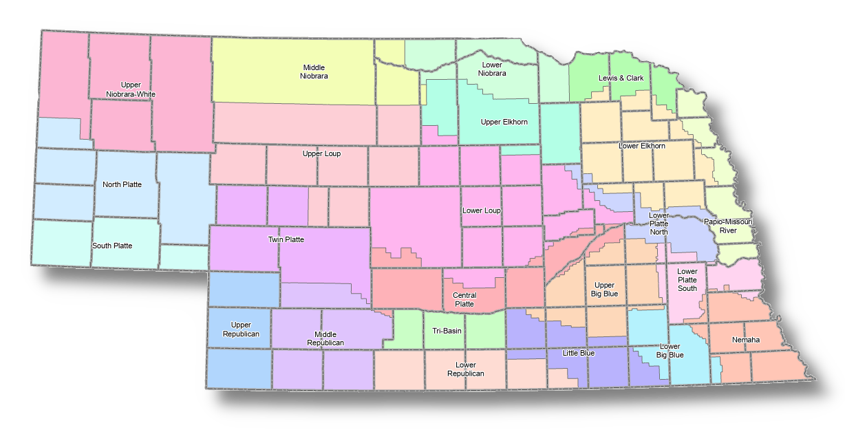
To find your local NRD, utilize the following map:
Who can volunteer to join NeRAIN?
NeRAIN is a community project. Everyone can help, both young and old. The only requirements
are an enthusiasm for watching and reporting weather conditions and a desire to learn about
the power and beauty of our natural world, along with the ability to upload data using a
computer or smartphone. NeRAIN welcomes participation by any motivated individual, family,
or groups such as schools or clubs.
How does the program work?
Volunteers are asked to read their rain gauge at 7 AM each morning. While 7 AM is the target,
any time within a couple of hours before or after (5 AM – 9 AM) would still provide useful information.
The rainfall amount received during the prior 24-hour period is then uploaded to the website via
the volunteer’s smartphone or computer.
Additional information may also be uploaded. During the winter volunteers may upload snow depth,
or the amount of water in the snowpack on their property. Users may report hail or other
intense storm activity. Other useful information could include the intensity of drought
(presence of cracks in the ground, dry vegetation, etc.).
Recording when it doesn’t rain it is just as important to report as when it does rain. Statistically,
recording a zero for precipitation is equally important as recording a storm.
What happens to the data?
NeRAIN information is updated daily and is available for public access on this website.
The data can be seen on an interactive map as well as in several reports.
The data may be downloaded in table format.
The data is also transmitted several times each day to the Community Collaborative Rain, Hail,
and Snow Network (CoCoRaHS). CoCoRaHS is an international database for precipitation and weather
events based in Fort Collins, Colorado on the campus of Colorado State University. The data
provides important daily decision-making information for agriculture, industry, home water use,
utility providers, insurance companies, resource managers, and educators. The data is used by
the National Weather Service to ground truth weather radar returns and to fill in information between official weather stations.